WILMINGTON, MA — Tony LaVerde, the GIS Coordinator in the Town’s Engineering Department, recently created a map of Wilmington circa 1775, highlighting known homesteads, main roads, and small paths.
The map was recently uploaded to the Wilmington Town Museum’s new website.
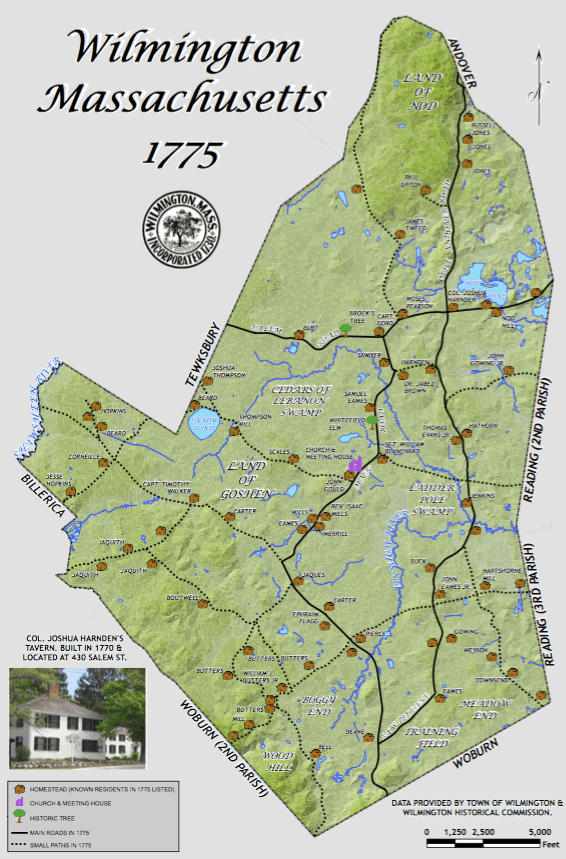
A larger, clearer version of the map can be found HERE.
Like Wilmington Apple on Facebook. Follow Wilmington Apple on Twitter. Subscribe to Wilmington Apple’s daily email newsletter HERE. Got a comment, question, photo, press release, or news tip? Email wilmingtonapple@gmail.com.
